
Paris Township Neighbors: Block Sources
Paris Township neighbors are best researched as a small group of nearby parcels. County maps and property cards establish land boundaries and the record owner for each selected lot. The Recorder adds conveyance and plat history. The election system can provide lawful, dated voter-address information in supported outputs. Zoning and permit records may place a documented change at one address. Each source has a different scope, so an owner, a voter, a person named in a filing, and a current occupant should not be treated as the same fact.
| Source | What It Shows About a Block | Access |
|---|---|---|
| GIS and Beacon | Adjacent-parcel layout, parcel identifiers, owner and tax-payer fields for individually selected lots | Public viewer or county counter; compare lots manually. |
| Tax maps, plats and surveys | Lot lines, road, plat and survey context | Portage County GIS, Tax Map, or Recorder. |
| Recorder instruments | Conveyances, easements, plats, named parties and legal descriptions | Recorder eSearch or Recorder counter. |
| Voter report generator | Eligible public voter-address and district information in supported report styles | BOE report route, subject to statutory exclusions. |
| Permit and zoning records | Dated construction or regulatory evidence at a particular address | County lists, township route, or a targeted request. |
| Historic repositories | Earlier household, map, poll-book, directory and newspaper evidence | Library, historical society, and genealogy collections. |
Use these records to identify the right land and context, then verify the exact question with the custodian. The county’s parcel record is not a directory of every person attached to an address, and a current address result does not make a map a census.
Map Paris Township Neighbors by Parcel
A parcel is the mapped unit of land used by the county. Start with the subject address in the Auditor or GIS system, then use the parcel number and map number to inspect the lots that physically touch it or face it across the same frontage. The research did not verify a direct adjacent-parcel or buffer button, so the responsible method is a manual comparison of individual property cards. That restraint matters on irregular rural lots and along roads where a map edge alone can mislead.
- Find the address in the Portage County Property Search and GIS Viewer, then retain the subject parcel and map numbers.
- Identify the touching parcels or lots across the same frontage, then open each property card separately rather than assuming a single map selection reaches them all.
- Compare the location address, owner address, tax-payer address, legal description, and the record date for each card. Those fields can differ.
- Check an apparent boundary against a scanned tax map, recorded plat, survey, or legal description before using it as a block conclusion.
The practical flow is address to subject parcel, subject parcel to surrounding map numbers, map numbers to individual cards, then cards to plats or Recorder instruments when the edge is uncertain. For a full named-road record trail, use the Paris Township street directory rather than expanding a block check into a streetwide claim.
Paris Township Neighbor Parcel Edges
The Portage Beacon field schema separates a location address from the owner address and tax-payer address. It also includes parcel number, map number, acreage, legal description, neighborhood, township, tax fields, and selected improvement data. That separation is useful because an owner’s mailing address may be elsewhere, while a parcel’s situs address identifies the land. A listed owner can also be a trust, estate, entity, or co-owner. None of those fields establishes every person who may be at the property.
Use the live property card as a navigation aid and verify important land questions against the Recorder or Tax Map. The parcel card cautions that its legal description is not for legal documents, and its land-use label is a valuation category rather than zoning. When a boundary is irregular, record the legal description and compare the recorded plat or survey instead of relying on a screen line. This keeps a neighbor search tied to the county’s actual land records.
Paris Township Neighbor Voter Records
The county’s documented address-oriented election layer is the Portage voter report generator. It offers PDF Avery-5160 labels, PDF reports, downloadable CSV, and a statistical report or update graph. Its verified options include group-by-household, voter districts, voting history, election selection, party, precinct, district, mailing-address inclusion, and sorting by voter name, precinct, walking list by voter address, or precinct walking list.
Those controls can make a specific civic record easier to inspect, but they do not make the output a complete household list. Ohio Revised Code 3503.13 and 3503.153 protect several voter-data categories, including confidential voter information and specified identifiers. Safe at Home participants are absent from public voter database and poll-list information. Individual ballot choices are not public. Retain the report date and filters, because voter status and district assignments may change.
For an individual verification, the county form requires first and last name; the state form separately requires name and county. An address-oriented report should be used only within the legal limits of the election record. Note: A walking-list sort describes an output order, not a county finding that all adults at an address share one household.
Paris Township Neighbor Zoning Clues
Building and zoning files can add a dated layer to a block when the question concerns a particular construction or regulatory event. Portage County’s Building Department serves Paris Township and publishes current monthly permits plus a 2014 through 2025 archive. A reviewed list uses record number, issue date, street number, street name, township or village, construction type, business name, and estimated cost. A permit line is evidence of an issued record, not proof of completion or a list of people at the address.
The Paris Township zoning meetings route provides the source for this local zoning view.
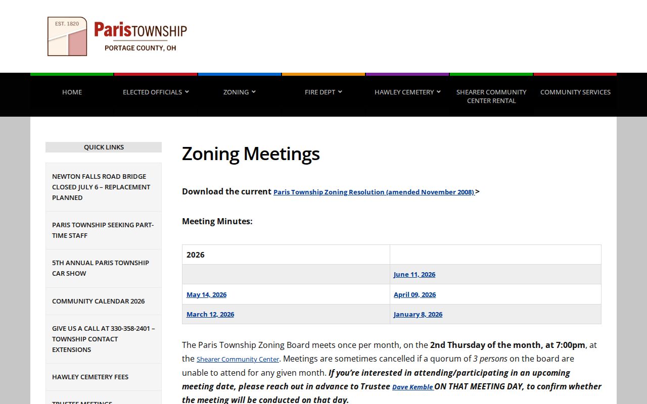
The meeting route supports a focused request or review of public zoning materials, while the township has no verified online searchable permit database. The township resolution requires zoning certificates for specified construction activity and says Board of Zoning Appeals records and minutes filed with trustees are public records. Ask for the exact address, date range, and existing file rather than requesting a broad compilation.
Paris Township Community Directory Gap
No authoritative public Paris Township HOA, neighborhood-association, civic-council, congregation roster, or block-watch directory was located. That is a real local limitation, not a missing link to replace with an unrelated service. The township’s public contacts route people to roads, zoning, fire, Hawley Cemetery, the community center, and the Little Free Library, but those service contacts are not member lists and should not be used to infer participation or an address.
| Local directory category | No authoritative public Paris Township roster was located. |
|---|---|
| Township service contacts | Paris Township official site supplies public service and department routes, not a resident directory. |
| Historical community route | Portage County Historical Society and PCCOGS hold dated local material. |
A dated library or repository item plus an independent government record is more reliable than assuming a public community roster exists. The absence of a roster does not indicate that no organization or community relationship exists.
Historic Paris Township Neighbors
For earlier blocks, the repository layer is stronger than a modern parcel card. Kent State Special Collections holds a physical telephone, city, and Portage directory collection with inclusive dates from 1918 through 2020. Reed Memorial has in-library local-history and genealogy material. PCHS and PCCOGS maintain Paris Township material, cemetery volumes, obituary files, poll books, tax and marriage records, maps, newspapers, probate indexes, and census microfilm. Each item has its own date and coverage, which must stay with the result.
Historic neighbors may appear in a directory, poll book, census, newspaper, map, or probate file, but no one source is a continuous household record. The 2026 PCCOGS Ravenna Arsenal displacement research includes Paris Township homes, farms, and families displaced in 1940 through 1943. For an affected place, match maps, deeds, tax records, photographs, newspaper items, and repository material before assuming a current parcel label describes an earlier block.
Paris Township Neighbor Source Comparison
Official sources and commercial neighbor tools answer different questions. County records identify the parcel, record owner, document, or lawful voter fields that the custodian actually maintains. Commercial tools combine data from other sources and can be stale, incomplete, or mismatched. Use an official record to verify the narrow fact it is designed to show, especially when names, mailing labels, or parcel numbers overlap.
| Source category | Useful for | Limit to keep in view |
|---|---|---|
| Official parcel and Recorder records | Land identity, named parties, legal-description and conveyance context | They do not create a current list of everyone at a location. |
| Official election records | Limited, dated registration and district information allowed by statute | Protected data and protected voters remain excluded. |
| Commercial neighbor tools | A possible prompt for a fact to verify independently | Accuracy, date, source, and lawful use can be unclear. |
The useful rule is simple: preserve the parcel number, report date, case or instrument number, and custodian. Do not let a summarized listing override the record that actually supports the fact.
Privacy Limits for Paris Township Neighbors
Parcel lines show land topology, meaning how parcels relate on a map. They do not reveal every person connected with an address, utility customer, delivery recipient, or protected resident. Owner, tax-payer, voter, directory subscriber, and resident are different concepts. A missing result may reflect a protected record, a different custodian, a date gap, an index issue, or a deliberate confidentiality rule. It should never be used as proof that a person is absent.
Ohio Safe at Home protects substitute-address and identifying information for eligible participants through R.C. 111.41 through 111.47. Ohio’s redaction forms hub covers a request to remove specified sensitive identifiers from an online public record when the law applies; it does not erase accurate historic land or court records. A person who believes an official record is wrong should contact the custodian that maintains it.
Lawful use. Use Paris Township neighbor records for lawful personal, civic, historical, and property-curiosity purposes. Never use an address, map, or record result to stalk, harass, intimidate, or harm anyone.