
Walk Paris Township Streets by Address
Paris Township is an unincorporated Portage County township, so an address question usually begins with a county parcel record instead of a township resident roll. A title holder, a tax mailing destination, and a person living at an address are separate facts. The county property and GIS tools establish the parcel that uses the street number. The Recorder then identifies land instruments connected to that parcel. Election and historical sources can add limited, dated evidence, but none turns the result into a complete list of everyone connected with a road.
- Search the Portage County Auditor property route by address, owner name, or parcel number. Record the situs address, parcel number, and legal description.
- Open the same parcel through the county GIS links. Compare street frontage and nearby parcel identifiers rather than relying on a map edge alone.
- Use the parcel's current owner and legal description in the Portage Recorder eSearch index to find the acquisition instrument and earlier transfer clues.
- If election information is relevant, use the county voter-report route only for its lawful public-record purpose. Its walking-list sort is not a household census and excludes protected records.
- For an older address trail, compare a selected directory or census year with the deed history. The Paris Township directory book route identifies local collections without treating a telephone listing as proof of continuous residence.
Keep a short source log as you go: address spelling, parcel number, legal description, instrument number, and the date of each record. It prevents a later name match from being attached to the wrong Paris Township property.
Paris Township Street Directory Parcels
The Auditor's Beacon search is the strongest current starting point for a Paris Township street directory search. Its documented paths include Quick Search, owner name, property address, parcel number, and an interactive map. Start with the standardized situs address when known. The parcel number is the more durable link when a road label changes, a property has an off-site mailing address, or a title record needs to be checked at the Recorder.
| Beacon route | Input | Street-research use | Important limit |
|---|---|---|---|
| Quick Search | Text | Starts a focused address, parcel, or owner query | Check the live prompt before using a broad phrase |
| Owner name | Name text | Finds parcels titled to a matching indexed owner | Name spelling and entity format matter |
| Property address | Address text | Finds the situs address and parcel | A situs identifies land, not every person there |
| Parcel number | Parcel text | Connects Auditor, GIS, Tax Map, and Recorder work | Use it with the legal description for older research |
| Map/GIS | Map selection | Locates a parcel and nearby identifiers | Map boundaries need plat or survey confirmation |
Portage County's Beacon parcel-search interface is the captured source for the current property-search screen.
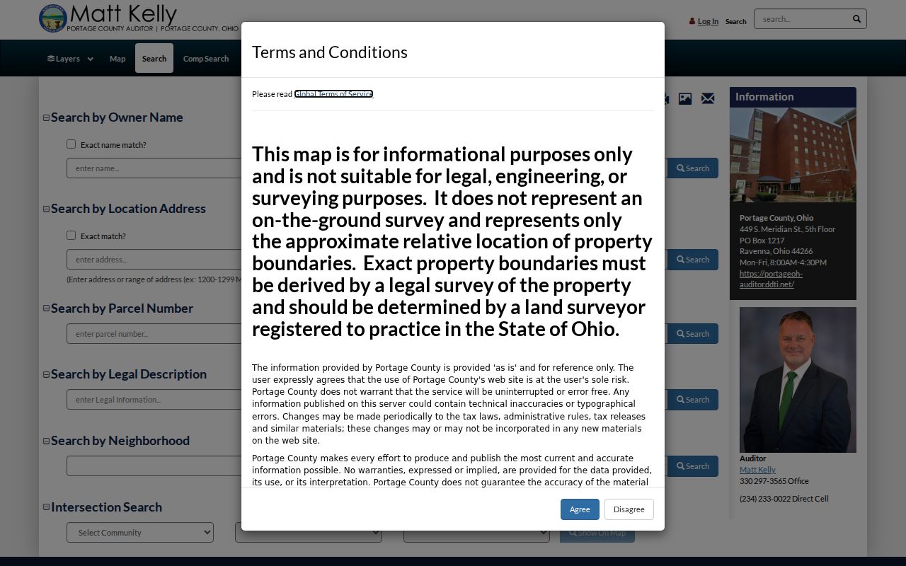
The property card separates location, owner, and tax-payer fields. That distinction is central to a by-address search because a mailing field can point away from the physical parcel.
Paris Township Street Records
A single address can appear in several public record systems, each with a different purpose. Portage County's Records Search handoff, the Auditor counter, the Recorder counter, GIS staff, township zoning, and a targeted county department request provide fallback routes when a web result is incomplete. Match each record to the question being asked. A permit can date work, for example, but it does not establish a current person at the address.
| Address-keyed source | Custodian | What it can show | Access channel |
|---|---|---|---|
| Parcel and tax record | Portage County Auditor | Parcel, situs, owner or mailing data, values, map links | Beacon or Auditor counter |
| GIS, tax map, plat, survey | County GIS and Tax Map | Parcel geography, map context, recorded plat and survey paths | Viewer, GIS hub, staff request |
| Recorded instrument | Portage County Recorder | Grantor, grantee, recording details, legal description | eSearch, counter, historical books |
| Zoning file or minutes | Paris Township | Existing certificates, plans, inspections, or public action where retained | Inspector, minutes, targeted request |
| Building permit list | Portage County Building Department | Street number, street name, date, work type, and record number | Published lists and targeted file request |
| Election report | Portage Board of Elections | Limited public voter-address and district data in supported output | Report generator, subject to protections |
For an unclear property, give the receiving office the parcel number, legal description, approximate date, and the existing document wanted. Ohio's Public Records Act, R.C. 149.43 supports a request for responsive existing records, not a new title abstract or a new list of people.
Map Paris Township Street Parcels
The county's map layer is useful for moving along a street one parcel at a time. Select the subject parcel, preserve its parcel or map number, note the identifiers touching it or facing the same frontage, then open each relevant property card individually. On an irregular lot, compare that apparent edge with scanned tax maps, Recorder plat maps, Tax Map Surveys, and the recorded plat. The research did not verify a direct adjacent-parcel or radius control, so a careful manual comparison is the supported method.
Portage County GIS and Tax Map links provide the captured route to the county's property viewer, tax maps, plats, surveys, and related records.
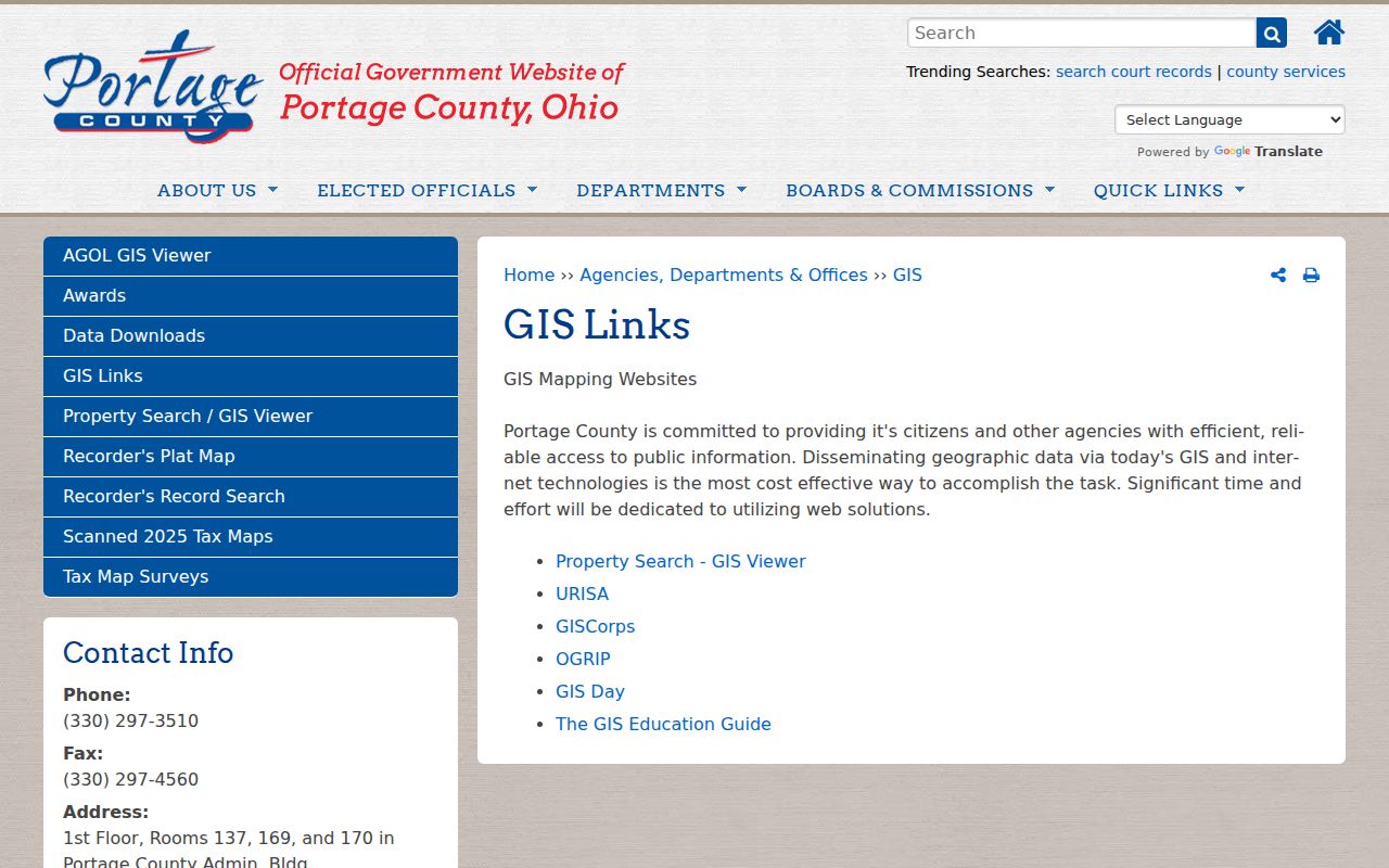
Use the GIS image as navigation evidence only. A displayed parcel can help identify where to look next, while the Recorder instrument remains the controlling source for a land transaction.
Paris Township Street Address Keys
Paris Township house numbers follow a county Tax Map process after a deed transfer has been recorded. The documented Minor Subdivision procedure calls for the recorded instrument number, then a return to Tax Map for a house number with approximate building size and placement. The process has no house-number charge. Paris Township's address-sign form addresses the physical sign after that step, but it is not a public address database and does not replace the county parcel process.
- Parcel
- A numbered unit of land used by the Auditor, GIS, Tax Map, and Recorder to keep a property trail together.
- Situs address
- The physical location attached to a parcel. It can differ from the owner or tax-payer mailing address.
- Plat
- A recorded map that can show lots, blocks, subdivisions, and their relationship to roads or other parcels.
- Legal description
- The deed's land description, such as a lot, block, subdivision, or metes-and-bounds statement. It is stronger than a guessed old street number.
Note: Tax Map is the documented house-number route, while the township form documents sign placement and service rather than separate address authority.
Trace Paris Township Street Deeds
The Recorder's public index is a name and instrument trail, not a confirmed street-address search. Online indexed records begin in 1979. Printable images begin in 2001, and the 1979 through 2000 period is identified by book and page. Search a current owner as a grantee to find the acquisition, identify the seller, then search that seller as a prior grantee while carrying the legal description through each transfer. The same name or a nearby parcel is never enough by itself.
When the online trail reaches the cutover, take the book and page or legal description to the Recorder counter. The historical books, tax maps, County Archives/Microfilm route, and local repositories are the documented next channels. This is the practical Portage County solution when web history fails: do not force a guessed street number into a name index.
Note: A named owner may be an individual, trust, estate, entity, or co-owner, and a later conveyance must be checked against the same legal description.
Date Paris Township Street Work
Portage County's Building Department serves Paris Township and posts current monthly permit lists plus an archive labeled 2014 through 2025. The reviewed list format includes a record number, issue date, street number, street name, township or village, construction type, business name, and estimated cost. That makes the list useful for placing a documented project in time. It does not confirm completion, a current household, or the full contents of the underlying file.
The county building-permit archive is the captured source for those dated lists.
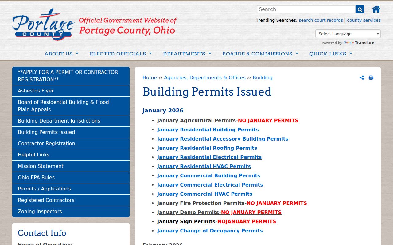
Filter a published list for Paris Twp., retain the record number and issue date, then request the particular file from the department if the event matters to an address history.
Paris Township Street Zoning Files
Township zoning is the local address-file layer. The Zoning Inspector issues certificates, reviews plans, performs field inspections, maintains records, responds to questions, and investigates complaints. A focused request can name an address, approximate date, and record type, then ask for existing certificates, plan-review records, inspection records, or enforcement correspondence. No official online permit database, universal application form, published copy charge, or historic coverage date was located, so the inspector and township records route matter.
Paris Township's zoning inspector page is the source captured for this local contact and records path.
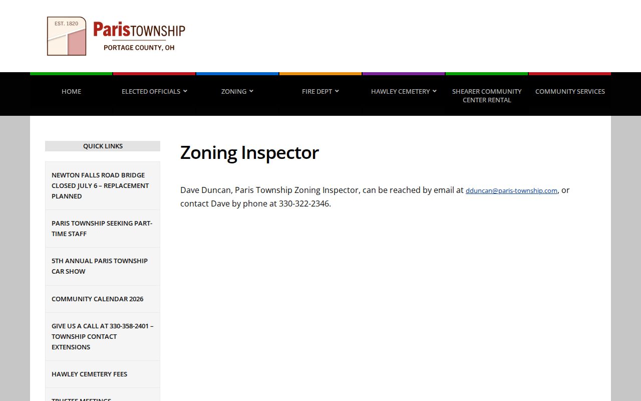
The zoning file can date a local regulatory event at an address. It should be read beside the county parcel and deed record, because it is not a substitute for title or an all-purpose street directory.
Paris Township Street Voter Limits
The Portage voter-report generator supplies the county's documented address-oriented election layer. Its choices include walking list by voter address and precinct or walking-list sort, along with optional household grouping, mailing-address inclusion, districts, election history, party, precinct, and output formats. That can support a narrow civic records task when the selected filters and report date are retained. It is not a street-by-street list of all adults or all people who receive mail at a location.
Registration information is public subject to statutory exclusions and confidentiality protections. Safe at Home data and other protected voter information are not disclosed through the ordinary public database. The individual voter lookup itself requires first and last name, so it is a separate confirmation path from the report generator.
Paris Township Street Postal Labels
A Paris Township physical address can use a Ravenna 44266 postal city while remaining outside the City of Ravenna. That is a records-geography issue, not a conflict to solve by choosing one label. Keep the postal delivery address, the County GIS township layer, and the Recorder legal description as separate facts. For a location near an edge, verify the delivery ZIP with the full address through USPS and verify government geography through the parcel record.
State Route 5 and State Route 225 are county-managed under the township's community-services distinction, while other road questions may begin with township contacts. Road responsibility can guide a records request, but it does not alter the parcel or deed trail. This rural overlap is why a Paris Township street directory needs both township and county sources.
Paris Township Street Directory Limits
No public Paris Township street directory can establish every person connected to an address. A property card reports a parcel and title or tax fields. A map reports geography. A deed reports parties to an instrument. A voter record is a limited, dated election record. Older directories, census records, cemetery material, and local archives add historical clues with their own dates and gaps. Read the precise record for the narrow fact it supports, then preserve the source and date instead of making a broader claim.
Lawful use. Use Paris Township address records for lawful personal, family-history, or civic research only. Ohio's menacing-by-stalking law, R.C. 2903.211 prohibits a pattern of conduct that knowingly causes fear or mental distress, so never use findings to track, harass, or harm someone.